


 1 comment
"The horseless carriage is here,” the Vineyard Gazette announced in 1900. Or was it 1903 when the newspaper credited James W. Lee with its arrival? Or was it Ned Mulligan of Oak Bluffs who took the first spin that same year?
What’s known for certain is that in 1905, more than a century before the Triangle became a summer curse, there were enough cars that the Edgartown selectmen were setting village speed limits. That year they ordered speedometers kept at four miles per hour, or the “speed of pedestrians walking at a brisk rate.” It was rescinded quickly when motorists squawked.
The number of vehicles started climbing from there: in 1911 there were ninety-three cars, according to William G. Manter of the Dukes County Garage, located at Five Corners in Vineyard Haven. By 1923 he counted 681, and by 1936 there were 2,108 serviced by the garage. An easy, relaxed relationship with cars continued for several decades. In 1949, for instance, Basil Welch cheerfully reported that over the summer the garage checked cars from forty-eight states, the District of Columbia, and four with foreign registrations. In 1955 the Edgartown police chief applauded the courtesies shown by both motorists and pedestrians during the busiest July Fourth weekend he had ever seen.
By the early seventies, however, the Island’s love affair with cars began to fizzle. Traffic forums, occasionally featuring state transportation officials, became a regular off-season feature. Come the mid-eighties, divorce papers had been filed.
“These roads can’t handle the influx of traffic,” said Oak Bluffs police chief Peter Williamson in 1986. “The traffic problem is not unique to down-Island. You take any [summer] rainy day and you can’t back out of your driveway from here to Gay Head.”
“Tourism is needed,” remarked Walter DelloRusso, an Edgartown planning board member in 1987. “But I think it’s got to be a more controlled, relaxed atmosphere or we’ll all end up on Level Four at Mass General in padded cells.”
The following spring, large margins of voters at every town meeting said they were in favor of capping the number of cars in the summertime (73 percent). They also voted in favor of limiting tour buses (89 percent) and halting moped rentals (85 percent). Similarly, a poll commissioned by the Vineyard Gazette found that 84 percent favored limiting cars to two per household.
That was thirty years ago, and the traffic files in the newspaper’s archives since then are literally overflowing. What to do, when to do it, and who foots the bill – those questions have engaged and befuddled multiple town boards, outside consultants, planners at the Martha’s Vineyard Commission, and residents (permanent and seasonal) for several decades. The issue came to a head again in 1997 with another round of town referenda and a decision by the Steamship Authority (SSA) to “constrain” ferry slots to the Island from June to August through the elimination of guaranteed stand-by.
But other than the roundabout at Barnes and Edgartown-Vineyard Haven Roads and a significant but not particularly traffic-easing increase in public transportation, there is little evidence that much has been achieved to mitigate the summer traffic on the Island. Quite the opposite, judging from the bumper-to-bumper bummers that appear like daylilies every July.
There are plenty of worthy contenders for the golden bottleneck award: West Tisbury center can be a nightmare when the farmers’ market is in full summer swing with the town library, Alley’s, and 7a also hosting a full house. And good luck making that left-hand turn at the Vineyard Haven end of the Edgartown–Vineyard Haven Road when the boat traffic empties onto State Road and Look Street cars are also trying to enter the fray. But it’s safe to say that any attempt to improve the general flow on the Island would have to start with the two most prominent chokeholds – Five Corners and the Triangle. According to Mike Mauro, transportation program manager at the Martha’s Vineyard Commission, Five Corners has “been studied through the gills.” The last few years alone has resulted in several hundred pages of Road Safety Audits, Project Need Forms, Project Initiation Forms, and Functional Design Reports. Suffice it to say they don’t make for easy bedtime reading: “Recommendations for any geometric and/or traffic control improvements are described in this report and presented in the 25 percent Design Submission....” Nor are they filled with particularly startling observations: “As a tourist destination, the island’s traffic volumes fluctuate greatly between the off-season (winter) and peak season (summer)....”
The findings, meanwhile, are rarely crystalline: one 2015 study of the Five Corners area announces that “crashes along this roadway segment occurred during off peak periods,” while another study in the same year by the same firm confidently presents data that 80 percent of the crashes occurred in the summer and that all of the accidents were during the “commuter peak.”
More interesting are the suggested possible changes to the area, ranging from clearer signage and road markings about who has the right of way to changing the direction of flow on various streets. One of the latter, changing the one-way direction of Union Street so that cars leaving the boat and heading up-Island can now avoid the snarl altogether, has worked reasonably well. (There is no sign offering that option, however, so don’t tell anyone.) Other suggestions, such as making Lagoon Pond Road a one-way street heading toward Skiff Avenue or closing the Beach Street Extension to all but service vehicles, seem unlikely to go anywhere.
The proposal that has gotten the most traction is the state Department of Transportation’s plan to create a shared use path that would reroute bicycles and pedestrians away from Five Corners altogether. But in February of this year a group of business owners, some of whom stand to lose a strip of their property along the road, petitioned the town to...have another study done. As of press time, the project is nearly fully designed, but its political fate is anyone’s guess.
The seemingly interminable politics coupled with whiplash reactions to change are why Mauro at the Commission believes it’s not so much a matter of uncovering some new, never-considered solution, but rather community will. “The problem is that for eight weeks of the year it’s an issue, but in the remaining months everyone just lives with it,” he says. “We talk about it for nine months as not that big a deal, but then for three months it’s the end of the world. I’d like to see it resolved around the question of do we want to improve it or not?”
After all, Five Corners may not be pretty, but it basically works most of the time. The Ingraham family has owned Island Color Center just a couple doors in from Five Corners on Lagoon Pond Road for almost fifty years. Carol and Bill Ingraham are the second generation to run the store, with their daughter Jenny often at the counter and ready to take the helm. Carol says her regular customers, particularly contractors and painters, know to come the back way and avoid Five Corners altogether.
“It’s one of the busiest intersections on the Island and there’s no place to reroute it,” she said. In her opinion “you can’t build another road. A stoplight won’t do it. And I don’t think a four-way stop would do it either.” And don’t even think about suggesting a traffic cop. “Having a cop there only makes it worse. I recognize they’ve been instructed to unload the boats as fast as they can, but meanwhile they’re backing up traffic all the way to the [Lagoon] bridge or Cronig’s.”
Over the decades the family business has done just fine whatever the boat schedule or season, she says, but she does have one major pet peeve. Drivers take note: “Those people who are coming down from Main Street towards Five Corners and they put on their right blinker and they’re not going right, but going straight. If you’re turning right, you’re turning onto Lagoon Pond Road,” she says. “It just irritates the crap out of me and everybody else.”
 Opinions are never in short supply on the Vineyard, particularly in the off-season. Remember the sustained delirium surrounding what was then the proposed roundabout? Handwringing notwithstanding, it got built after ten years of process and a prolonged funding search. Today, living with the Island’s sole roundabout has led some to wonder if replicating it elsewhere might offer relief.
To Mauro the roundabout could (or should) be viewed as a model in modernizing the Island’s road system. “I actually think the roundabout is the best infrastructure project on the Island I’ve ever seen,” he says. “I would like to think we could point to it as a prime example that it is possible to build better infrastructure without being invasive or ruining the Vineyard aesthetic.” He also points to the new extra lane that separates right and left turning drivers at the intersection of Barnes Road and the Edgartown-West Tisbury Road. Simple and effective.
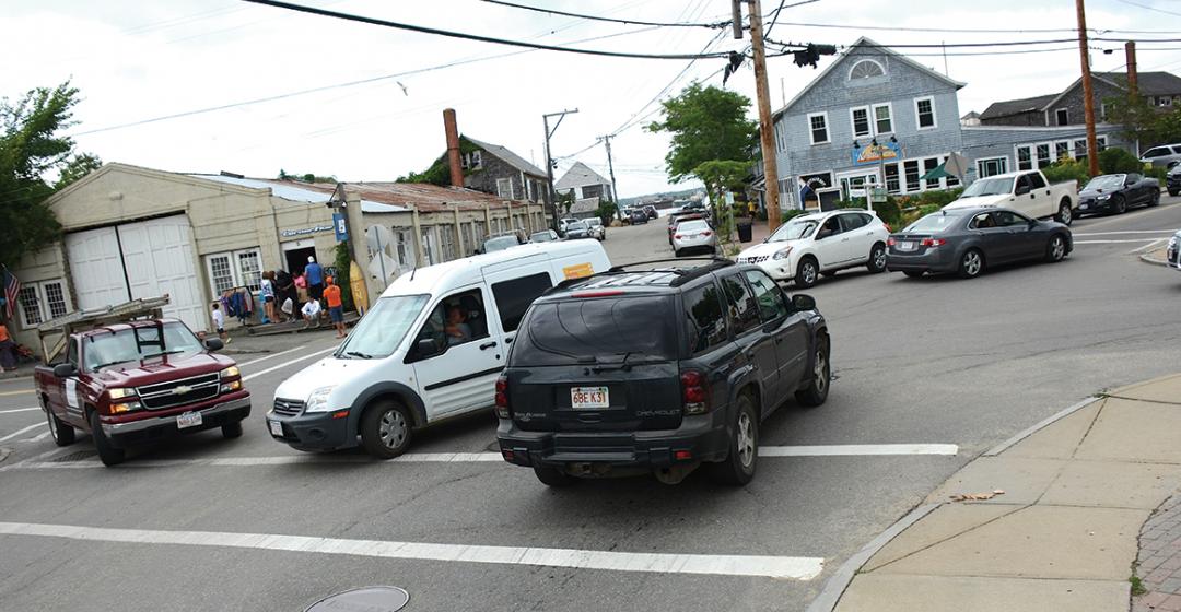
Simple, effective, and not in the middle of any downtown, he might have added. Less rosy Islanders gripe that the very efficiency of the roundabout has led to longer backups at both ends of the Edgartown-Vineyard Haven Road. In particular, through the roundabout and past the high school, lurks...the Triangle.
It, too, has been academically proven to be a traffic jam at certain times of the year. Fred Mascolo has both lived with the Triangle as the owner of Trader Fred’s, a clothing store, and overseen countless studies and meetings as an Edgartown Planning Board member for thirteen years and chair of the Upper Main Street Committee for five years. He disbanded the latter “after the third traffic study was discussed.” As with Five Corners, the suggestions for improving the Triangle over the years have included adding turning lanes, changing the direction of some streets, or making them one way.
Truth is, Mascolo is sort of done with it. “Change is hard,” he says. “But you have to call it for what it is and that’s an issue for forty-five days of the year. It’s the high season month of July and the first two weeks of August. But that’s forty-five days a year – when it’s not an issue for 320 days – and it’s only an issue twice a day. The first being in the morning and then it dies off, and around four-ish and it dies off around 6:30.”
Mascolo thinks retailers along the Triangle and Upper Main Street actually benefit from the seasonal stop-and-go traffic because people can be more primed to pick up something if for no other reason than to make the trip – and the wait – more worthwhile. And while underscoring that he does not speak for the full planning board, he sees the proposed Stop & Shop expansion as a win, citing more storage space for greater in-store selection, user-friendly parking, improved landscaping, and a quieter operation overall based on the submitted designs.
“And for 320 days a year we will reap the benefits of a larger Stop & Shop with more options in organic food and really, pretty much everything for our year-round population,” he adds. “We all agree we have an aging population and these new facilities will be much more user friendly with better access for parking and a bus stop so people don’t have to wait out in the cold.”
In the case of Stop & Shop, the Commission strongly recommended the store provide delivery service during the summer months in order to mitigate traffic. And the Edgartown Planning Board may use the occasion of the approval process to require other traffic related changes. But like the shared-use path in Vineyard Haven, as of press time the fate of the Stop & Shop and its impact on traffic at the Triangle is anyone’s guess.
 Sean Murphy’s office at the Edgartown law firm of McCarron, Murphy & Vukota sits at the top of Upper Main Street, literally overlooking the spillage from the Triangle stop sign and Beach Road. The view is so good one could take a seat, pop a soda, and click away on a hand-held traffic counter, which, of course, is available on Amazon along with traffic cones and vests. Murphy, who’s seen his share of town planning boards and Martha’s Vineyard Commission hearings, doesn’t believe the Triangle kerfuffle is solvable.
“You have fifty times more houses in Katama than were there in the seventies,” he says. “The people who are coming on this road are coming for a reason, and that’s to Stop & Shop or downtown, the beach, or wherever it is. It’s become the commercial center of Edgartown, and unlike Oak Bluffs, which has a million ways in and out of town, Edgartown only has one entrance into the downtown [area] from down-Island, and then the Edgartown–West Tisbury Road.
“Somebody once said, ‘The Island has grown exponentially since the sixties, but not one new road has been built other than roads leading in and out of developments,’” he adds. “We basically have the same infrastructure but everything is bigger – people’s cars; the landscaper who used to have one mower in the back of his pickup now has a trailer with four mowers.”
The same could be said of Five Corners, or, for that matter, of any of the other bottlenecks on the Island. But whose cars are they? Not day-trippers: according to the Martha’s Vineyard Commission’s regional traffic plan, 96 to 98 percent of summer weekday traffic is created by permanent residents, seasonal residents, and “long-term visitors.” The same report noted that fully 15 percent of the freight traffic on the boat line is devoted to hauling away 33,500 tons of trash annually, and that winter traffic has increased more rapidly than summer. “We have met the enemy,” as Pogo said as he looked over a mountain of litter, “and he is us.”
During the summer of 2017, the SSA brought 190,735 cars and trucks to and from the Vineyard. Ten years earlier the number was 165,721, and in 1997 the number was 145,416. In other words, in the decades since all the towns passed resolutions to limit the number of cars the ferries bring to the Island, and the SSA supposedly acted to constrain summer traffic, the boats have only gotten bigger and brought more cars and trucks. Specifically, the boats bring 31 percent more vehicles to the Island now than they did twenty years ago. “We try to respond to what the demand is,” SSA General Manager Bob Davis told the Vineyard Gazette last August in yet another clipping in the traffic files. “Clearly the Island has been building out over the years.”
We may be due, even overdue, for another hue and cry, and maybe another round of referenda. But for now it appears that for the six-week logjam we must all, seasonal and year-rounder, mostly grin and bear it. Maybe adjust our attitudes and our driving patterns to avoid the inevitable crush. Or park outside of town and walk in if we have to go to work. Forty-five days of changing routines or adding ten minutes to the commute doesn’t sound so horrible. But then again, because magazine deadlines are distant I’m writing this piece in early spring, not mid-summer. My attitude right now? I can do this. No problem.
Or you could look at it this way: Edgartown finally got what it wanted in its first attempt at traffic regulation – four mile per hour speed limits.
 What about the bus?
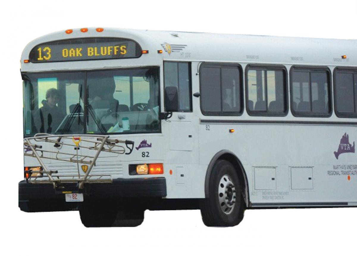
It’s been ten years since the Vineyard Transit Authority (VTA) became a truly Island-wide system. Angela Grant has been the administrator of the VTA for ten years longer than that. Today she oversees a fleet of thirty-two buses, with about twenty-eight in service the peak week of the Martha’s Vineyard Agricultural Fair. The first bus heads out about 5 a.m.; the last one leaves Edgartown around 2 a.m.
Grant sees the VTA as helping to relieve some of the growth and traffic issues on the Island, but adds, “It’s getting to the point where the growth factors are starting to catch up again. And collectively we’re sitting in the same traffic everyone else is.”
With six new electric buses on order and the goal to transition all buses as they age out, she sees the possibility of introducing some residential shortcuts at peak times. “Once the vehicles get
quieter and they don’t produce any smoke, those are conversations worth having,” she says.
The most popular routes? No surprise here – Route 1 along the Edgartown–Vineyard Haven Road, a dense residential corridor, and Route 13 along Beach Road between Oak Bluffs and Edgartown, which carries a lot of day trippers in the summer, but also those headed to the center of each town for work.
“I don’t know what the capacity of Martha’s Vineyard really is,” says Grant. “Do we like it this way or not? It’s really a matter of perspective and which side of the story you’re on.”
Or, perhaps, which side of summer you’re on.

Comments (1)