Lungs tight from kicking up sawdust on a newly cleared trail, I searched my backpack for my inhaler. Weariness was written on my friends’ faces too. A dusty, panting dog lay in front of us, his head turning slowly to drink from a bowl of water. We had been hiking for sixteen miles – a journey that began halfway across the Island at Katama Point Preserve.
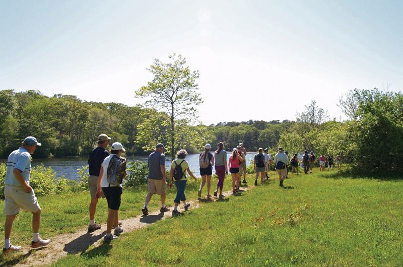
Almost fifty hikers had met more than five hours earlier under blue skies to embark on what would be a twenty-two-mile journey, beginning on the beach at Katama Bay in Edgartown and ending at Lambert’s Cove Beach in West Tisbury. With the cool breeze coming off of the bay, Bill Veno, one of the hike leaders, welcomed us and outlined the route from start to finish. “I don’t expect to see all of your faces there,” he said, “but I hope that you enjoy the portions that you choose to walk.”

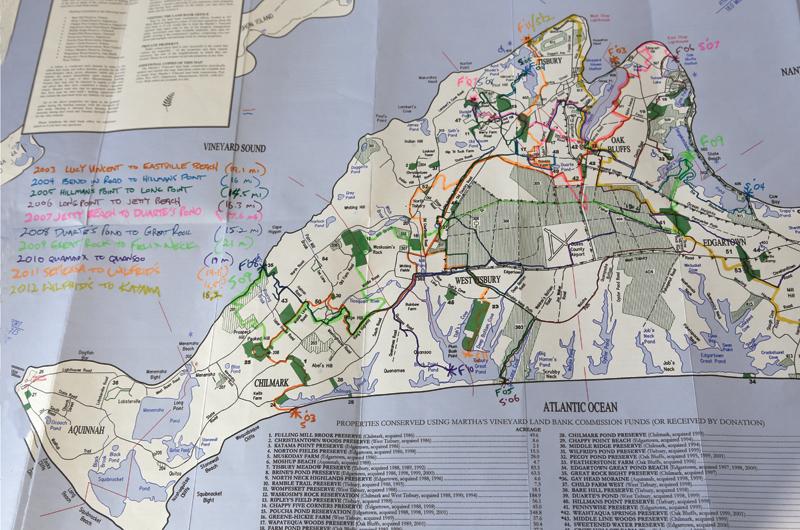
To say that Veno enjoys these walks is putting it mildly. Of the twenty-one annual cross-Island hikes that the Martha’s Vineyard Land Bank has organized, he has planned the route for sixteen of them, including the one we were on. Designed to showcase the interconnectedness of the Island’s trails, each walk begins where the previous year left off, creating a sort of slow-forming web. “It’s very gratifying to show people a way to walk around the Island on different properties,” he said of his role.
I, on the other hand, was a complete novice to this Island rite of passage, having heard about the hike only two years previously. Living here year-round can make the Island feel small, and I imagined a long-distance walk across it would add some perspective. Only a few hours into my journey, I learned I was right.
That morning, I awoke excited to start the adventure with my father and three friends in tow. We piled into the old family station wagon and headed to Katama Point, where we pulled out our maps, secured our backpacks, and followed the leaders single-file through Huckleberry Barrens preserve, along the fence line of the Farm Institute. We walked past Katama Airfield, through Muskoday Farm. A large chestnut horse warily galloped back and forth.

At mile 5.8 we spread out on the grass of Morning Glory Farm for our first rest stop, spirits still running high. Nearly six miles later, a group of passing bicyclists offered high-fives, a welcome offer of encouragement to keep moving forward.
The hike is designed to allow participants to join and depart at various locations along the route. Not everyone who hopes to finish will make it, and many have no intention of finishing at all. I intended to walk from coast to coast, however, as much to take in the scenery and learn the topography as to prove I could do it. Surrounded and bolstered by my fellow travelers, I dug down deep into my own reserves.
And everything was fine until around mile fifteen, at the Wapatequa Woods Preserve trailhead just beyond Thimble Farm, when I asked my friend, “What did you do with your banana peel?”
“I didn’t have a banana,” he replied, confused. That wasn’t a good sign. Somehow I had to pull it together. We still had several miles to go.
“I believe that there is a subtle magnetism in Nature,” Henry David Thoreau wrote in his essay Walking, “which if we unconsciously yield to it, will direct us aright.”
As I have many times before, I relied on nature for strength. With sore legs and heightened allergies, I focused on each step, one foot after another. Down Stoney Hill Road we went, across State Road where drivers honked and waved at the trail of hikers. Then through the pastoral John Presbury Norton Farm along stonewalls to Wompesket Preserve and into the Blackwater Pond Reservation. Now that I knew I would finish, my energy returned.
One by one we crossed the wooden bridge at Duarte’s Pond. Ahead of me, my friends spread out their arms, welcoming the light breeze across the water. Our spirits were lifted and smiles reappeared. We had hiked almost twenty miles.
We made our way up the sandy embankment at Lambert’s Cove Beach and all of a sudden, there it was. The ocean again glistened before us and a cooling breeze came across the water. Hugs and hoorays were shared.
Of forty-eight who started that morning, twenty-five of us had made it to the beach. Six hours and twenty-two miles. Some posed for photos; some sat in the sand and took off their shoes. Some ran into the water for a celebratory swim.
Two weeks later, after the blisters had healed, the sore muscles recovered, a certificate of completion arrived in the mail from the land bank. I look forward to receiving more in the years to come.
As always, the cross-Island hike will be held on National Trails Day, which this year falls on
Saturday, June 7. The route will be posted in May at mvlandbank.com.


